Qarshi
Qarshi (Qarshi/Қарши, ; Nakhshab) is a city in southern Uzbekistan. It is the capital of Qashqadaryo Region. Administratively, Qarshi is a district-level city, that includes the urban-type settlement Qashqadaryo. It has a population of 278,300 (2021 estimate). It is about 520 km south-southwest of Tashkent, and about 335 km north of Uzbekistan's border with Afghanistan. It is located at latitude 38° 51' 48N; longitude 65° 47' 52E at an altitude of 374 meters. The city is important in natural gas production, but Qarshi is also famous for its production of woven flat carpets.
Originally the Sogdian city of Nakhshab (which could be possibly named Eucratideia during the rule of Greco-Bactrian Kingdom ), and the Islamic Uzbek (Turkic) city of Nasaf, and the Mongol city of Qarshi (pronounced Kharsh), Qarshi was the second city of the Emirate of Bukhara. It is in the center of a fertile oasis that produces wheat, cotton, and silk and was a stop on the 11-day caravan route between Balkh and Bukhara. The Mongol Chagataid khans Kebek and Qazan built palaces here on the site of Chinggis Khaan's summer pasture. In 1364, Timur also built a fortified palace with moats in what is now the southern part of the city. The modern name "Qarshi" means fort.
Karshi developed steadily from the 14th century. During the Sheyban dynasty the town grew violently (16th century). It was the second largest town of Bukhara Khanate in the 18th century. During these centuries much of the city's magnificent architectural monuments were built. With the decline of Shahrisabz in the 18th century, Qarshi grew in importance, and was the seat of the Crown Prince to the Emirate of Bukhara. The city had a double set of walls, 10 caravanserais and 4 madrassahs during this time. By 1868, the Russians had annexed the Zarafshan Valley, and in 1873, the treaty turning Bukhara into a Russian protectorate was signed in Qarshi, much to the dismay of the Emir's son, Abdul Malik, who took to the hills in rebellion.
In the early 1970s, the first section of a major irrigation project was completed to divert water from the Amu Darya River in Turkmenistan eastward into Uzbekistan in order to irrigate the land surrounding Qarshi. Almost all of these irrigated lands around Qarshi are planted with cotton.
Map - Qarshi
Map
Country - Uzbekistan
 |
 |
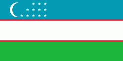
| Flag of Uzbekistan | |
The first recorded settlers in what is now Uzbekistan were Eastern Iranian nomads, known as Scythians, who founded kingdoms in Khwarazm (8th–6th centuries BC), Bactria (8th–6th centuries BC), Sogdia (8th–6th centuries BC), Fergana (3rd century BC – sixth century AD), and Margiana (3rd century BC – sixth century AD). The area was incorporated into the Iranian Achaemenid Empire and, after a period of Macedonian rule, was ruled by the Iranian Parthian Empire and later by the Sasanian Empire, until the Muslim conquest of Persia in the seventh century.
Currency / Language
| ISO | Currency | Symbol | Significant figures |
|---|---|---|---|
| UZS | Uzbekistan som | so'm or Ñўм | 2 |
| ISO | Language |
|---|---|
| RU | Russian language |
| TG | Tajik language |
| UZ | Uzbek language |


